ARIADNA
Maritime Volumetric Navigation System
Aims
Development of Volumetric Navigation System for maritime and inland navigation applications to support the navigation in dense traffic environments like ports, rivers, locks, and channels.
Brief Description
The objective of the project ARIADNA is to design and build-up a new series of navigation support systems to allow optimisation of the maritime infrastructures, the navigation on dense traffic in ports and access areas, rivers, channels, lock access areas, and traffic separation areas as well leading to efficient (in terms of capability and economic terms) and environmentally-friendly operations.
ARIADNA based products can be also useful to avoid human error in navigation, provide warning and manoeuvring support for collision avoidance, and provide risk and warning assessment to vessel and navigation control systems in channels, port access areas, narrow inland waterways and congested areas.
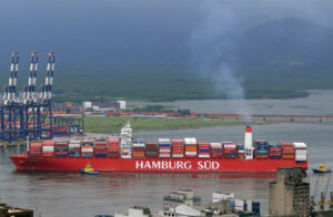
Ship information is already transmitted by AIS (Automatic Identification System), VTS (Vessel Traffic Service) and communication systems depending on the ship or vessel size, and equipment.
The manoeuvring constraints by vessels are considered within ARIADNA and each vessel transmits the information on his manoeuvring capabilities in such a way that the other ships in the area can manoeuvre with precise knowledge of the position of the other ships.
ARIADNA is based on the implementation of the Volumetric Navigation System (VNS) concept. In general, 3D volume dimensions are used to define the position and attitude of an associated volumetric safety envelope in time. In the maritime and inland navigation the “volume” of the ship is the envelope of the ship after a given time. Horizontal dimensions of this ship’s envelope will consider its current speed, the load, and correction for the drift due to local measured wind and mapped currents.
The display may overlap the Electronic Chart Display and Information System (ECDIS) screen. VNS is a human error avoiding tool for collision avoidance, manoeuvring and navigation in low separation traffic lines and channels, crossings, port traffic, congested shallow waters.
 Facts
Facts

Project Partners
- Ingeniería de Sistemas para la Defensa de España, Spain (lead)
- Instituto Nacional de Técnica Aeroespacial, Spain
- TeleConsult Austria GmbH, Austria
- via donau – Österreichische Wasserstraßen-Gesellschaft mbH, Austria
- CONSAR – Italian Shipowners Research Consortium, Italy
- Istanbul Technical University, Turkey
- True Heading AB, Sweden
- HSVA Hamburgische Schiffbau-Versuchsanstalt GmbH, Germany
- Grupo Mecánica del Vuelo Sistemas S.A., Spain
- Consultores Investigación Tecnológica S.L., Spain
Financing
- European Community, under FP7 of the European Union
Status
- Successfully completed in 2013